 freemapper
Examples
For each German state there is a sprint map and a forest map, each of an area from which freemapper can derive a lot. Most images show the check print: the map with every candidate, true to position, as one takes it into the terrain to check. It shows what freemapper derives and so looks fuller than a finished map. Viktoriapark already shows the training map, which one prints and runs on as it is; the other examples follow.
Click an image to see it large. The PDFs and the whole projects with OOM and OCAD files are on GitHub.
Sprint maps 1:4000
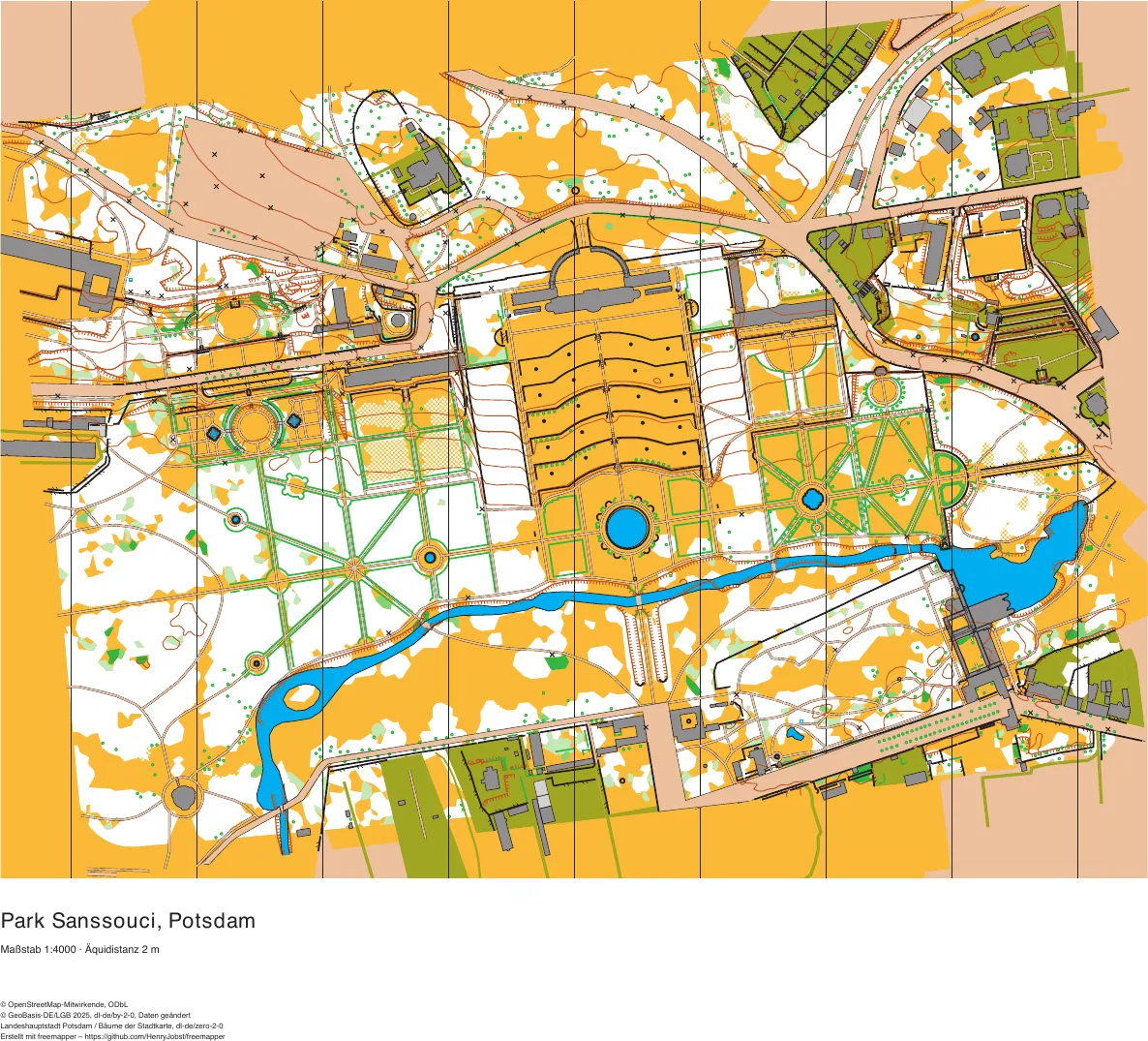
Brandenburg
Park Sanssouci, Potsdam
vineyard terraces, parterres and hedges, palace
2493 map objects · 773 candidates · 38 symbols
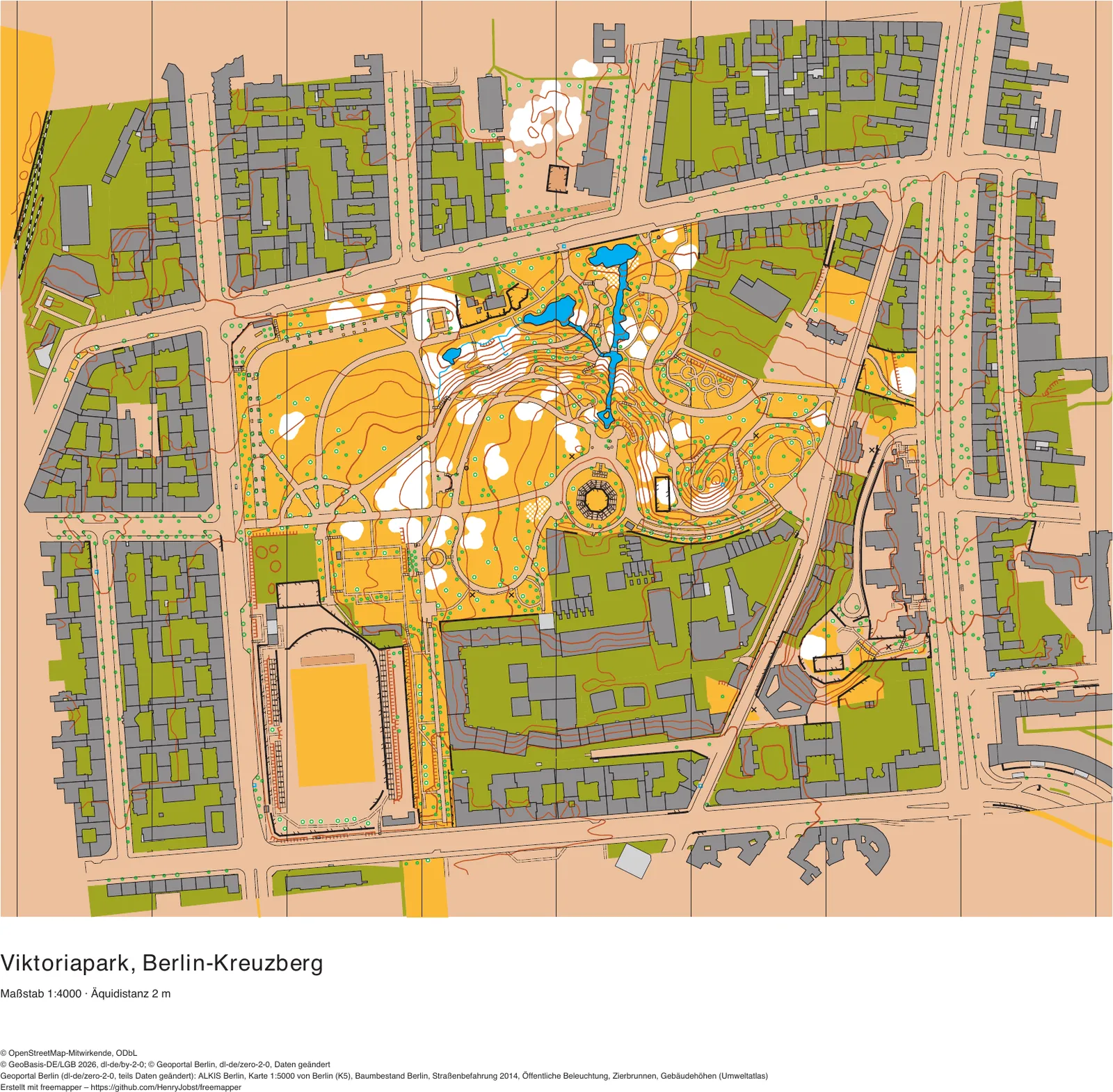
Berlin
Viktoriapark, Kreuzberg
the Kreuzberg hill with its waterfall, 19th-century blocks
3208 map objects · 692 candidates · 46 symbols
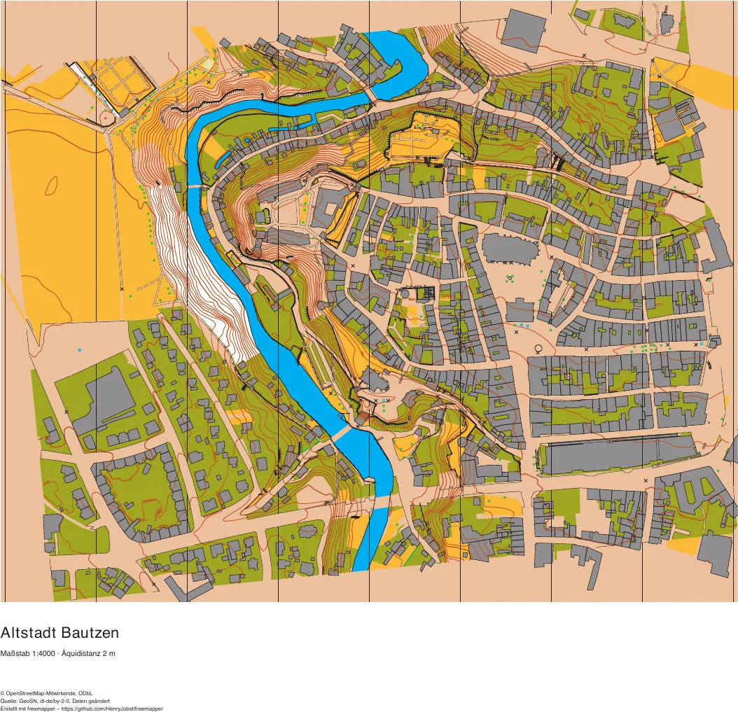
Saxony
Bautzen old town
the old town on the rock above the Spree, steep valley sides
2385 map objects · 1049 candidates · 39 symbols
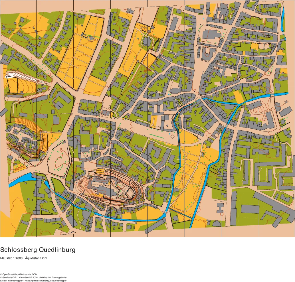
Saxony-Anhalt
Schlossberg Quedlinburg
World Heritage old town, castle hill, narrow lanes
2812 map objects · 638 candidates · 39 symbols
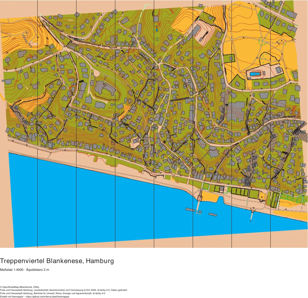
Hamburg
Treppenviertel Blankenese
the steep Elbe bank, stairs and lanes
2480 map objects · 1143 candidates · 38 symbols
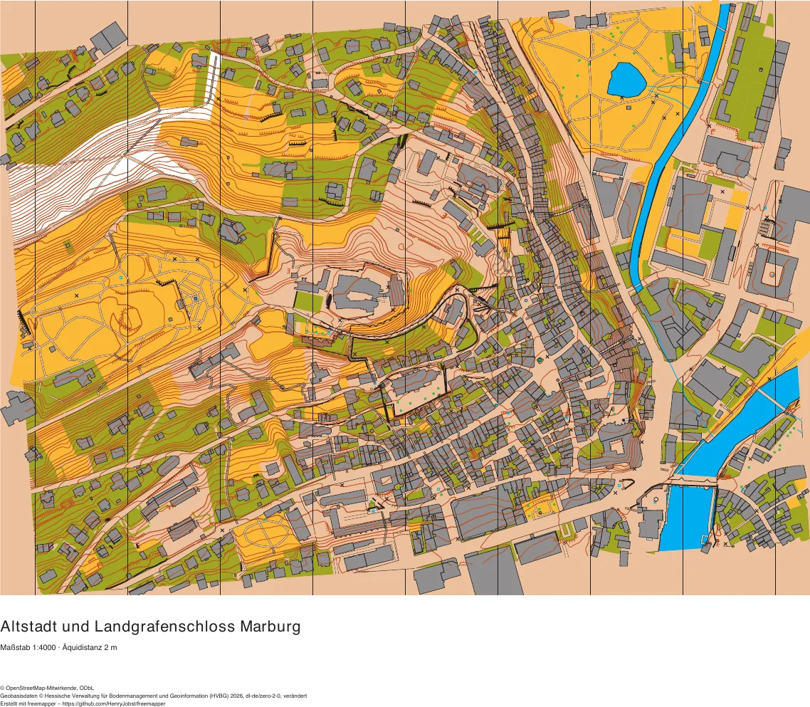
Hesse
Marburg old town and castle
the steep upper town with stepped lanes, castle hill
2883 map objects · 1122 candidates · 39 symbols
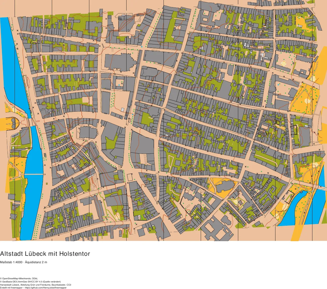
Schleswig-Holstein
Lübeck old town and Holstentor
the medieval old-town island with its passages and courtyards
3518 map objects · 1868 candidates · 35 symbols
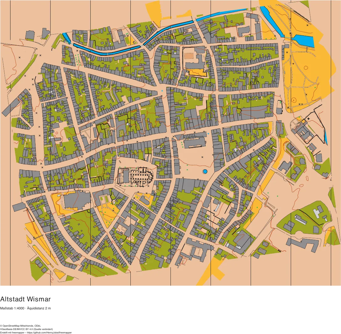
Mecklenburg-Vorpommern
Wismar old town
World Heritage old town with St. George's church and the market square
4068 map objects · 1659 candidates · 39 symbols
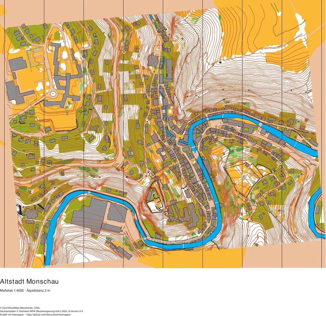
North Rhine-Westphalia
Monschau old town
half-timbered old town in the deep Rur valley
2042 map objects · 1651 candidates · 42 symbols
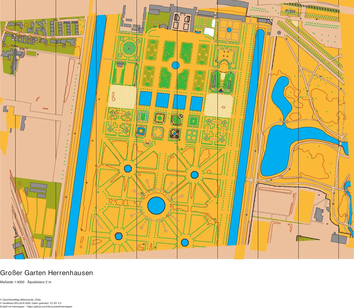
Lower Saxony
Großer Garten Herrenhausen, Hanover
baroque garden with hedges, parterres and fountain basins, next to the Georgengarten
2350 map objects · 336 candidates · 38 symbols
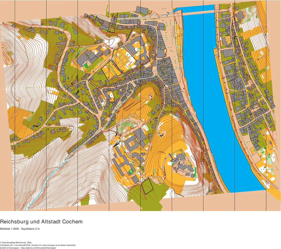
Rhineland-Palatinate
Reichsburg and Cochem old town
the castle hill with the Reichsburg, the old town on the steep Moselle bank, Cond across the river
2435 map objects · 1128 candidates · 44 symbols
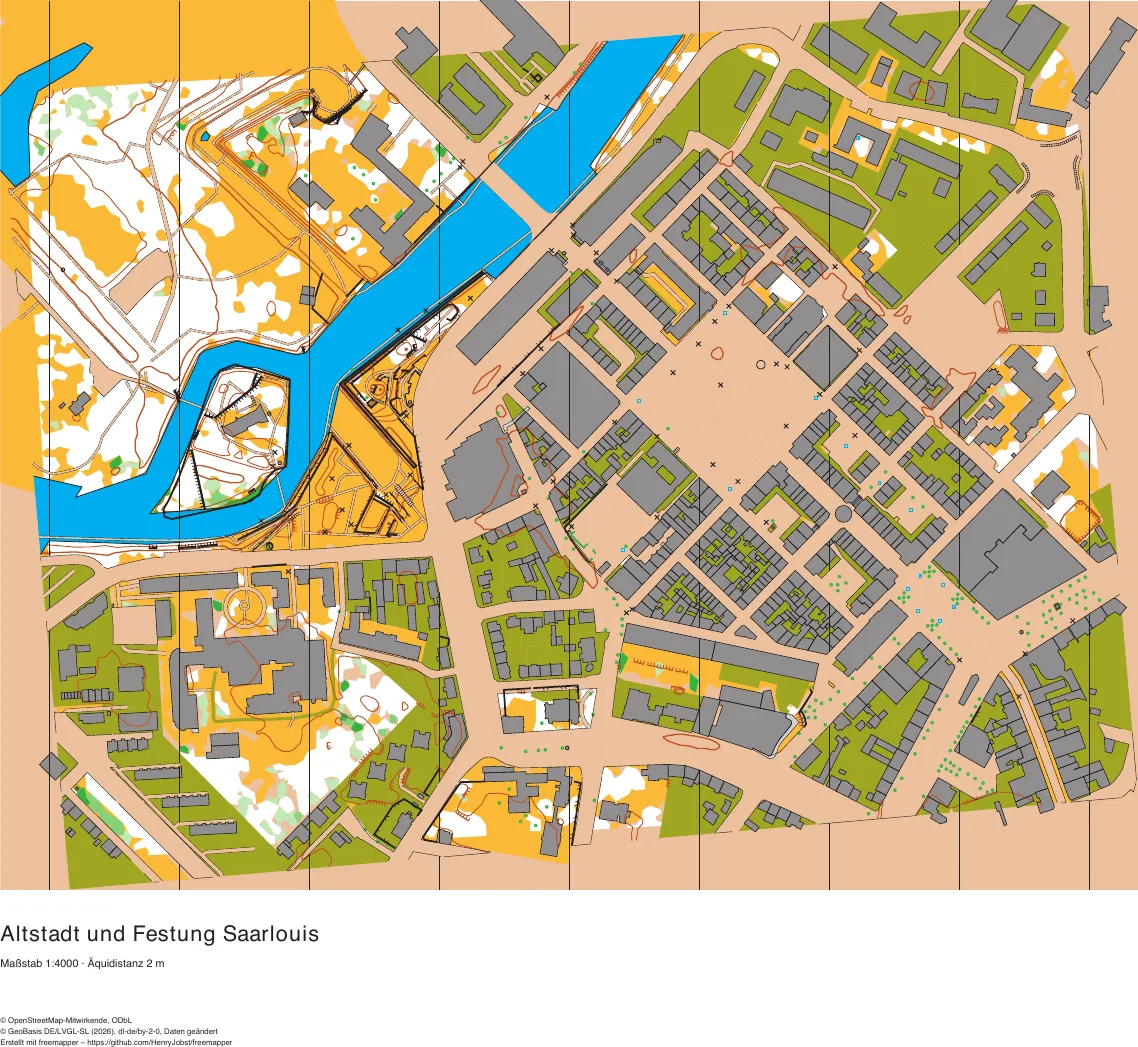
Saarland
Saarlouis old town and fortress
Vauban's hexagonal fortress town, the old arm of the Saar with the Vauban island, ramparts in the Stadtgarten
1627 map objects · 721 candidates · 40 symbols
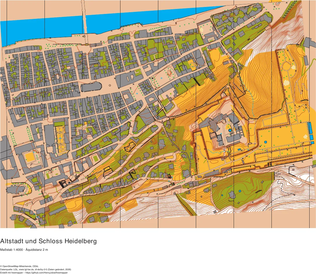
Baden-Württemberg
Heidelberg old town and castle
the old town on the Neckar with the Old Bridge, the castle and its garden on the steep slope of the Königstuhl
2473 map objects · 1019 candidates · 43 symbols
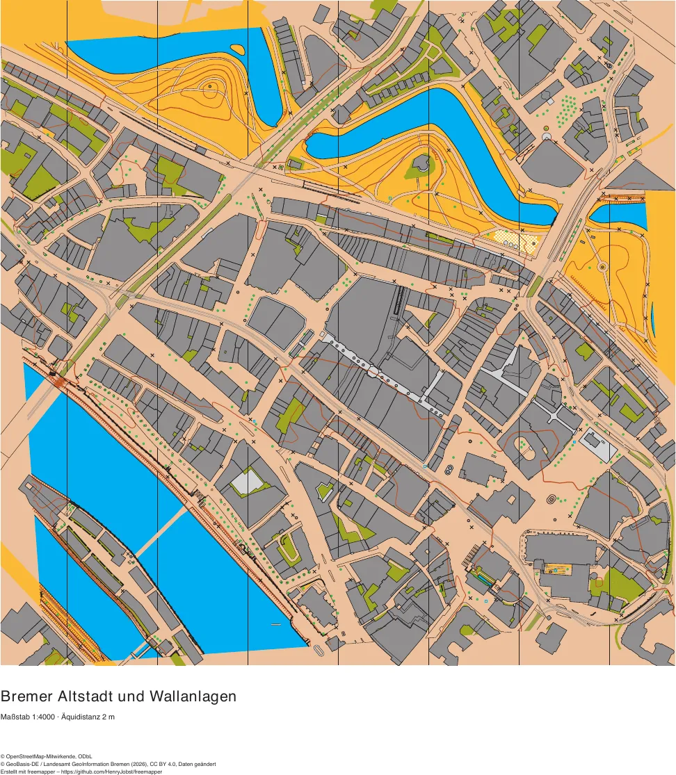
Bremen
Old town of Bremen and Wallanlagen
the old town between the Weser and the town moat with the market square and the Schlachte, the Wallanlagen with the mill on the rampart, and the Teerhof across the river
2399 map objects · 551 candidates · 39 symbols
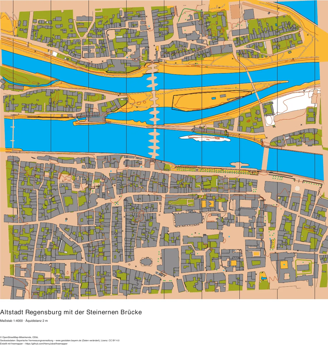
Bavaria
Old town of Regensburg with the Stone Bridge
the World Heritage old town on the Danube with the cathedral and its lanes, the Stone Bridge, the river islands and Stadtamhof on the other bank
2828 map objects · 461 candidates · 39 symbols
Forest maps
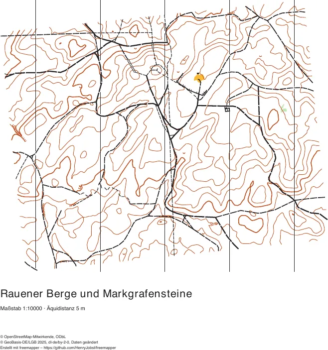
Brandenburg
Rauener Berge and Markgrafensteine
moraine hills above the Scharmützelsee with the Markgrafensteine, large erratic boulders
241 map objects · 38 candidates · 21 symbols
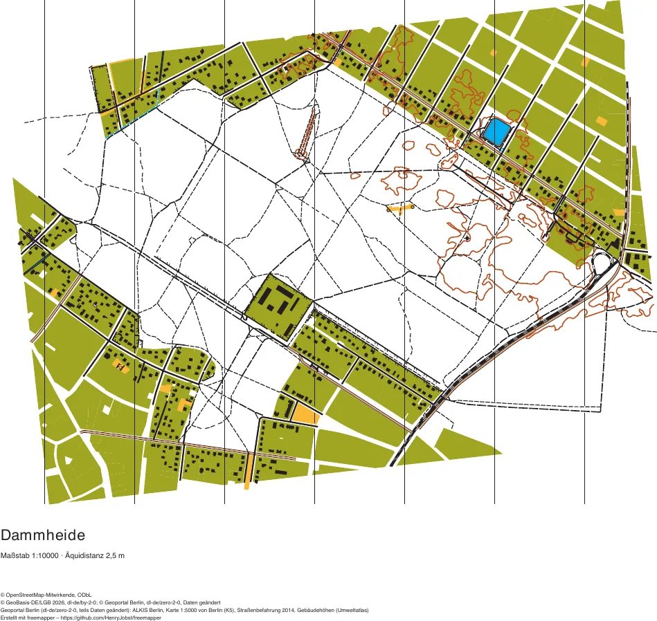
Berlin
Dammheide, Treptow-Köpenick
a small flat forest with a dense path network, settlements around it
1093 map objects · 166 candidates · 27 symbols
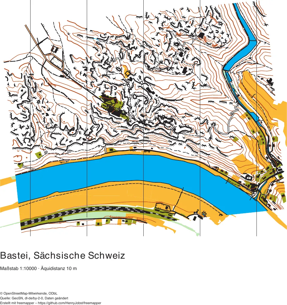
Saxony
Bastei, Saxon Switzerland
sandstone rocks above the Elbe, more than 2000 cliffs from OSM
1331 map objects · 3158 candidates · 36 symbols
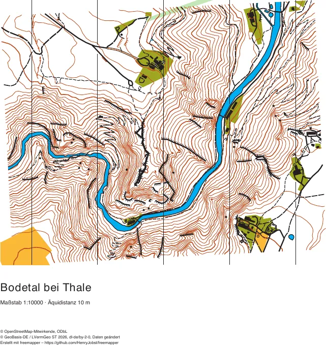
Saxony-Anhalt
Bode valley near Thale
the deep valley of the Bode in the Harz
536 map objects · 168 candidates · 35 symbols
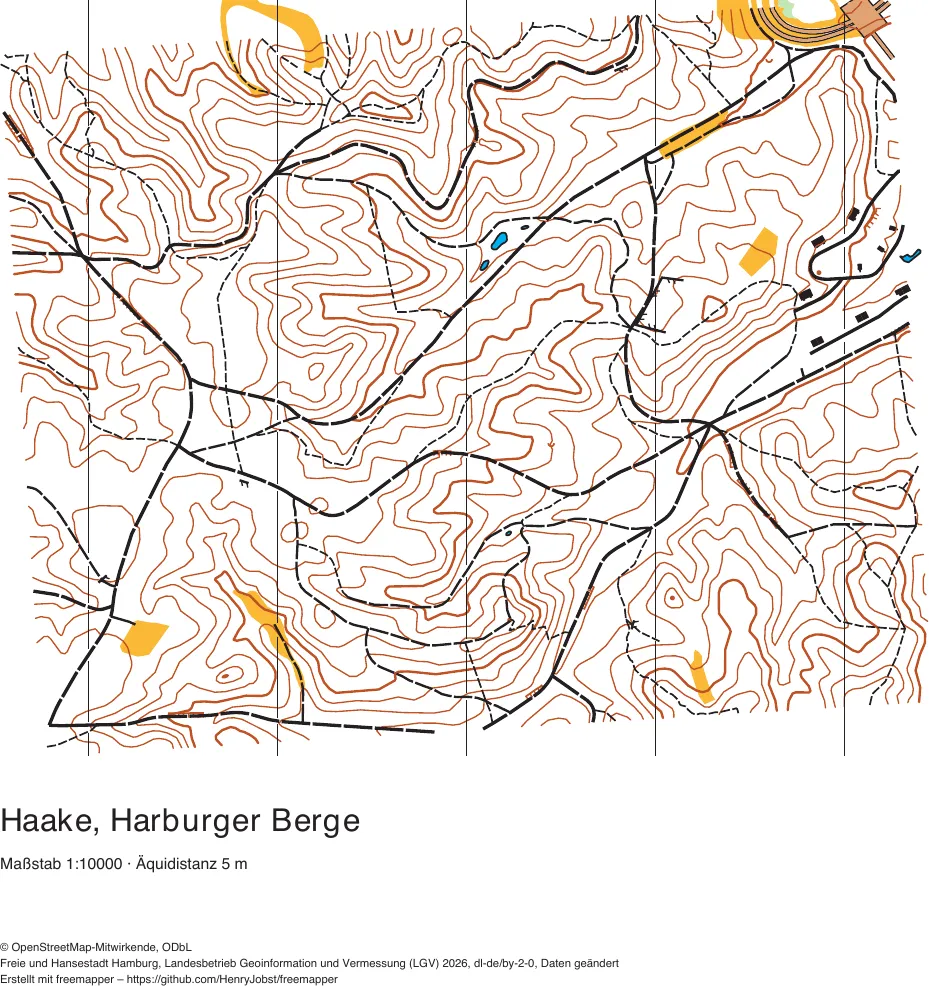
Hamburg
Haake, Harburger Berge
a hilly forest with a dense path network
254 map objects · 33 candidates · 23 symbols
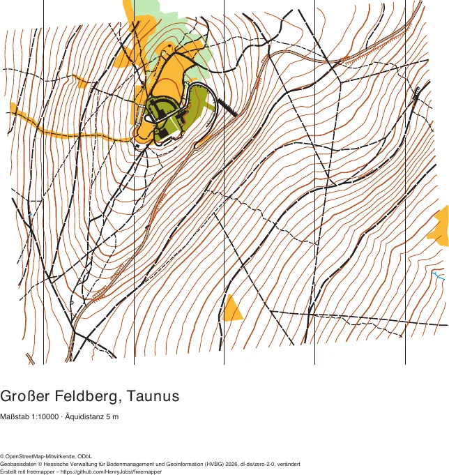
Hesse
Großer Feldberg, Taunus
the summit and slopes of the highest mountain of the Taunus
302 map objects · 43 candidates · 29 symbols
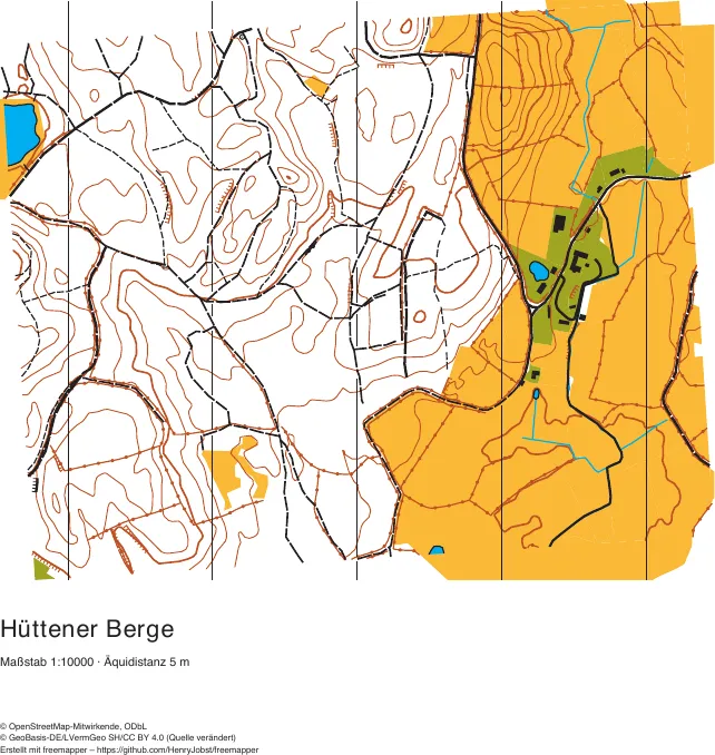
Schleswig-Holstein
Hüttener Berge
moraine hills with forest, open land and small lakes
225 map objects · 112 candidates · 25 symbols
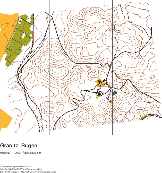
Mecklenburg-Vorpommern
Granitz, Rügen
beech forest around the Granitz hunting lodge
188 map objects · 101 candidates · 24 symbols
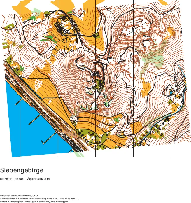
North Rhine-Westphalia
Drachenfels, Siebengebirge
rocks, vineyards and forest above the Rhine
1041 map objects · 328 candidates · 40 symbols
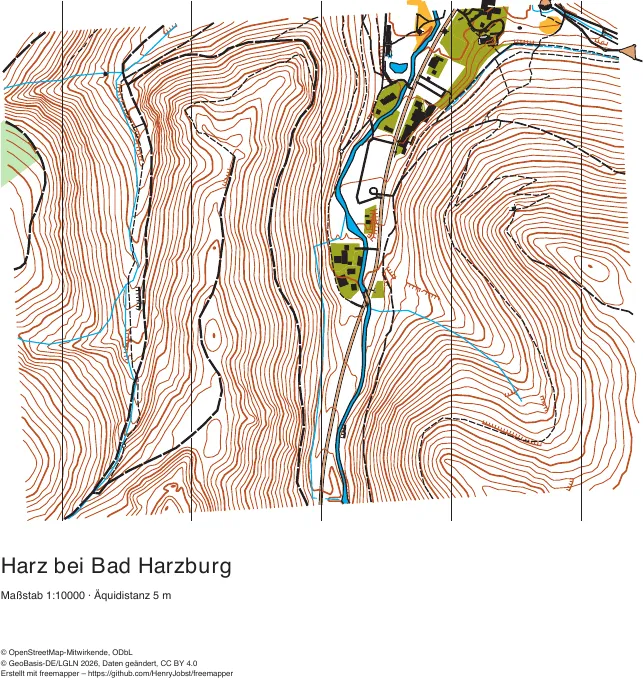
Lower Saxony
Harz near Bad Harzburg
steep slopes on both sides of a stream valley
398 map objects · 51 candidates · 33 symbols
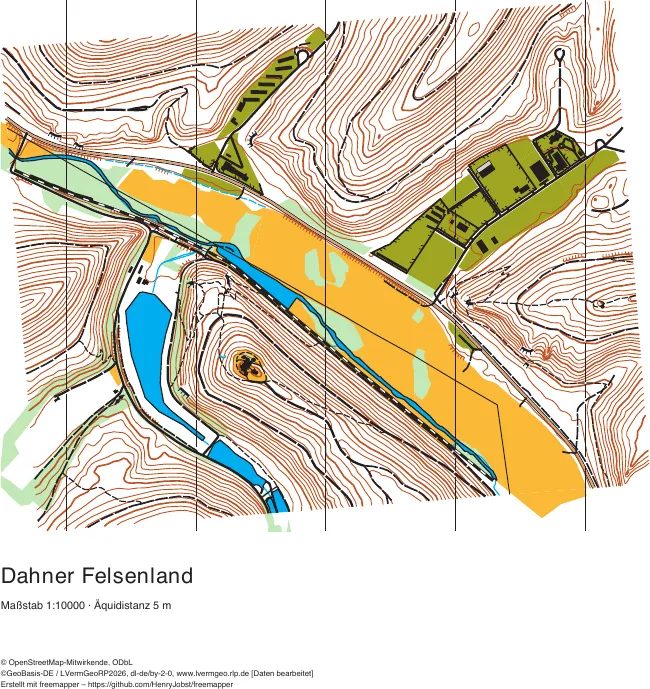
Rhineland-Palatinate
Dahner Felsenland
red sandstone rocks in the Palatinate Forest
484 map objects · 124 candidates · 34 symbols
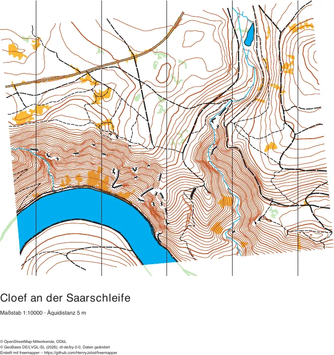
Saarland
Cloef at the Saarschleife
a steep slope with rocks above the Saar loop
393 map objects · 132 candidates · 26 symbols
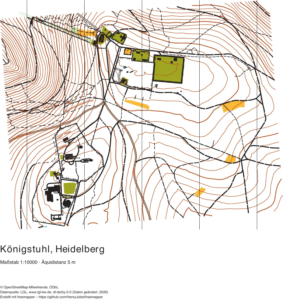
Baden-Württemberg
Königstuhl, Heidelberg
Heidelberg's own mountain, with an observatory and many paths
499 map objects · 47 candidates · 28 symbols
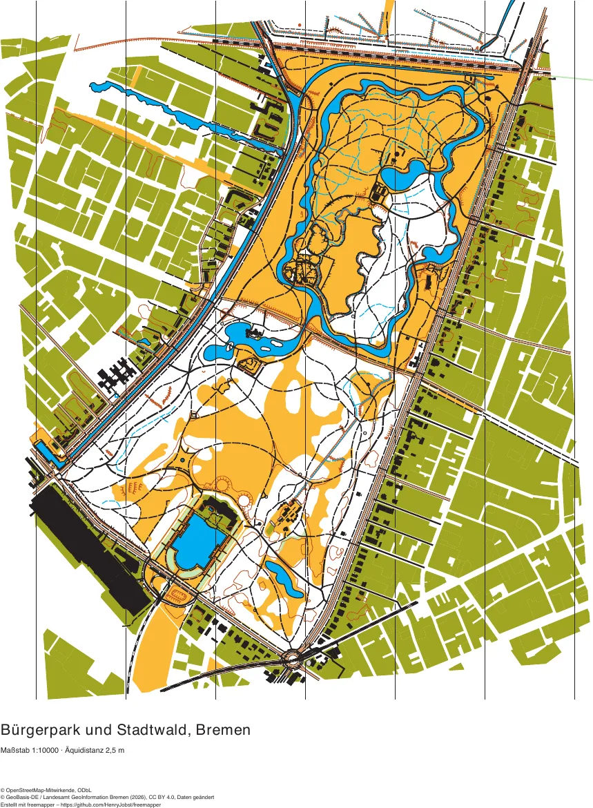
Bremen
Bürgerpark and Stadtwald
a flat park and forest with ditches, lakes and a dense path network
1792 map objects · 420 candidates · 32 symbols
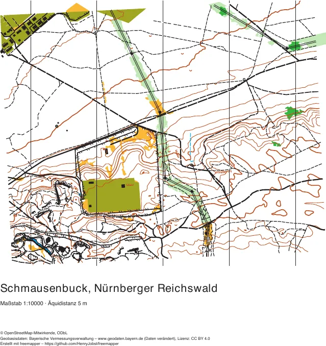
Bavaria
Schmausenbuck, Nürnberger Reichswald
a sandstone hill in the Reichswald above the zoo of Nuremberg, slopes with a dense path network, two power lines
437 map objects · 140 candidates · 37 symbols